Accurate detailed maps, site plans and digital terrain modelling are necessary components for all successful development projects.
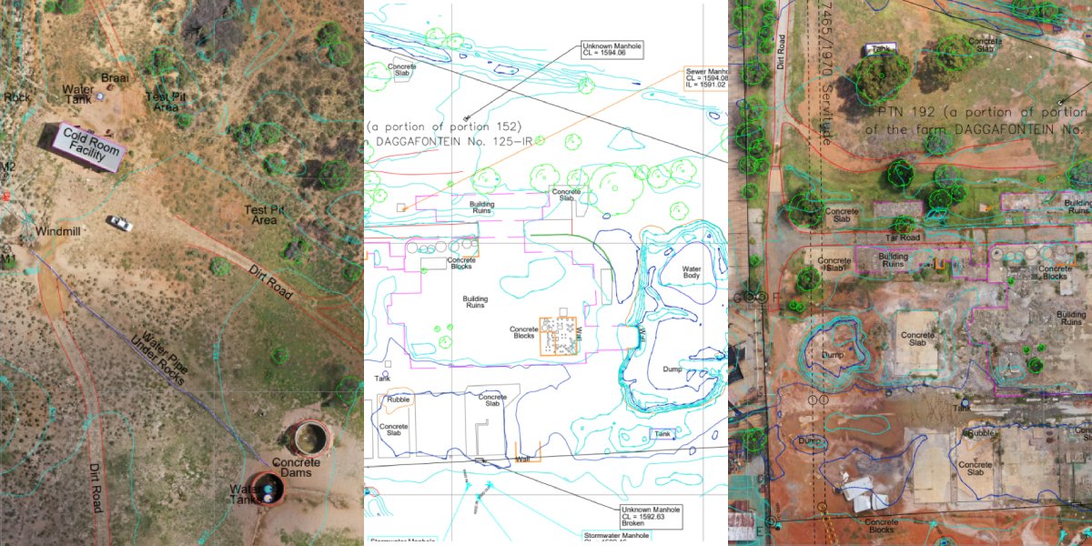
Detail surveys of sites will show existing infrastructure, building footprints, services such as storm-water, sewerage and cabling, contours and elevations, property boundaries and any other features pertinent to the design process.
We provide these maps based on survey techniques that combine 3D Laser scanning, aerial drone based mapping and traditional survey methods.
Underground services detection mapping can be included in these plans if required.
Deliverables:
Include Autocad DWG or Revit files, Orthophoto files in Geotiif or ECW formats, Modelmaker, Land XML , 3dMesh formats and various point cloud formats.